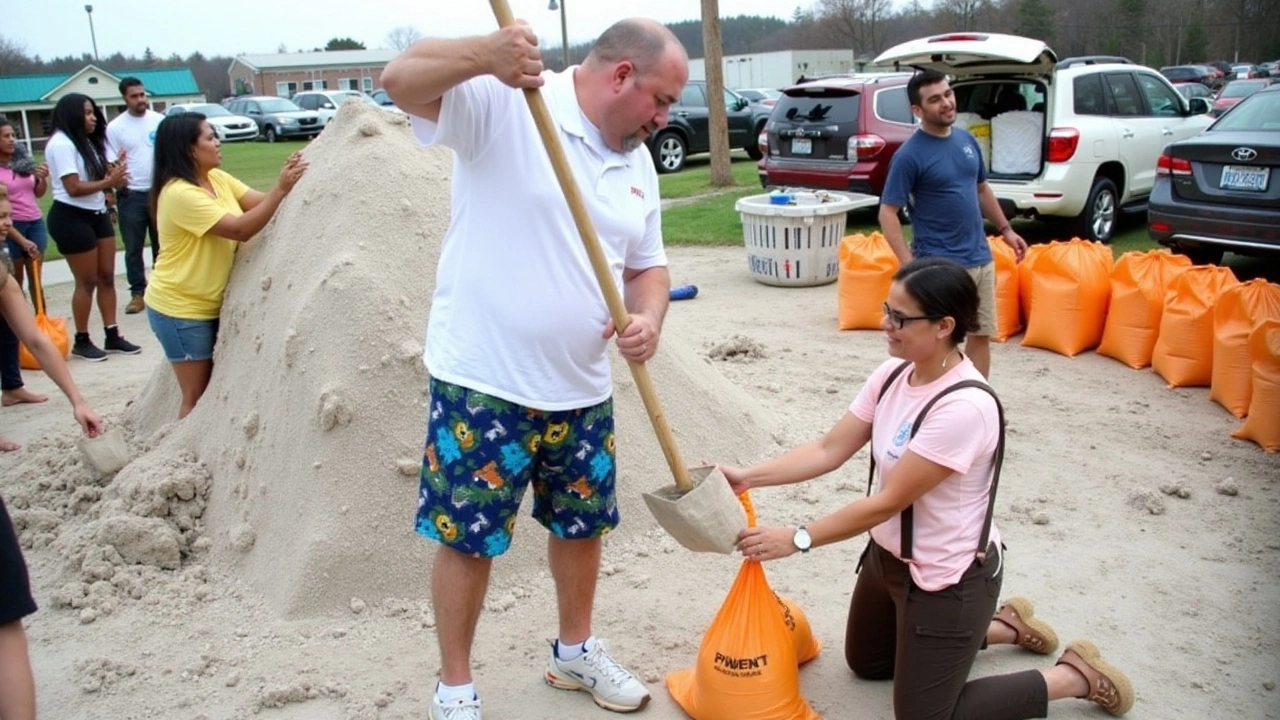
Hurricane Milton's Menacing Approach
The ominous arrival of Hurricane Milton approaches Florida's Gulf Coast, carrying with it an imminent threat of destruction unseen in recent history. Formed in the warm waters of the Gulf of Mexico, the storm swiftly became a formidable Category 4 hurricane, causing ripples of anxiety along the coastline. This natural leviathan is set on a course for Tampa, instigating a chain of emergency responses that underscore the gravity of the situation. Floridians, still in recovery from the trauma inflicted by Hurricane Helene mere weeks ago, now face the stark reality of another climatic assault. The state braces itself yet again, balancing on the precipice of nature's fury.
Predictions and Preparations
The National Hurricane Center has not minced words in its forecasts, labeling Hurricane Milton as potentially one of the most destructive storms to make landfall in west-central Florida. With an anticipated landfall projected for late Wednesday or early Thursday, residents are in a frenzy, preparing for the worst. The decision to downgrade Milton from a Category 4 to a still-extremely-dangerous Category 3, due to some weakening in wind speeds, offers scant comfort. Gusts are expected to haul themselves onto the shores with sustained speeds of 125 mph; capable of wreaking havoc on homes, infrastructure, and the natural landscape alike. The unpredictable nature of storm intensity forecasts keeps everyone on high alert, knowing the situation could escalate just as easily as it could stabilize.
The Eye of the Storm
Discussions on the storm's trajectory focus heavily on the position of Milton's ominous 'eye.' Dubbed one of the key determinants in assessing damage potential, the eye's path will manifest as a focal point of both hope and fear. Should the eye pass to the east of Tampa Bay, the already burgeoning anxiety reaches new heights. On this 'dirty side' of the storm, winds gather unmitigated strength – a chaotic blender of rain and debris that spells imminent danger for those caught in its path. Tampa's local leadership and emergency services monitor this development with bated breath, knowing full well the implications for public safety and structural integrity.
Life-Threatening Storm Surge
A confluence of factors make the storm surge predicted from Hurricane Milton particularly menacing. Florida's Gulf Coast's geographical layout renders it vulnerable, its protruding peninsulas become easy targets. Forecasts warn of surges climbing to life-threatening heights of 10 to 15 feet, elevating the urgency of current evacuations. Even those accustomed to the seasonal wrath of hurricanes find themselves concerned, prompted to reconsider their initial hesitations. Such staggering levels require precision in both governmental readiness and personal responsibility, if they are to mitigate loss of life and limb.
Evacuation and Precautionary Measures
Evacuation drills come alive with fervor; a systematic relocation of thousands is in progress, fueled by pointed warnings and administrative orders. Mandatory evacuations see residents streaming out of Tampa Bay and surrounding vicinities, defying the stubborn valor that some may feel towards the impending catastrophe. Not only those directly in Milton’s projected path have felt the effect: as far as Miami-Dade, Broward, and Monroe counties to the south, schools close and airports halt operations, grounding both human and flight alike in an effort to safeguard against unnecessary perils.
Community's Response and Awareness
Leadership stands as a beacon in the haze of uncertainty. Tampa Mayor Jane Castor epitomizes this, leveraging available resources to urge residents towards taking preemptive action. Her stern reminders resonate in the memories of Helene's devastation, where lower storm surges still caused immeasurable damage. These lessons remain fresh in the minds of those now contemplating evacuation and safety. Castor underscores that Milton's surge will not only dwarf previous measures but impact a broader swath of Florida’s west coast.
Continued Fluctuations in Intensity
As meteorologists peer into the swirling storm data, the spectrum of possibilities remains open-ended. While certain fluctuations in Milton’s intensity are expected, they continue to stress the existence of a powerful hurricane lurking ahead. Now, more than ever, the dissemination of timely and accurate information is vital. The space between normalcy and chaos shrinks as residents scramble to adhere to safety protocols. The Tampa Bay area's coastal residents, alongside those extending up through Georgia and South Carolina, remain vigilant, watching the weather and emergency bulletins for their next moves.
Conclusion: Bracing for Impact
Florida, often showcased as the battleground for America's most notorious hurricanes, stands once again in the crosshairs of Mother Nature's formidable forces. Hurricane Milton, while holding the promise of unpredictability, forces all stakeholders to gear up with life-and-death seriousness. As history unravels over the coming days, it is not only the meteorological feats detached scientists watch; Milton’s path casts long shadows over livelihoods, ecosystems, and legacies that will be tested and, in many cases, transformed. In a state woven from the fibers of resilience, Floridians hold onto hope, unity, and the unyielding spirit that makes each hurricane season a chapter in their story of survival.


When a storm like Milton looms, it forces us to confront the fragile line between nature's indifference and human resilience. The convergence of power and vulnerability reminds us that every gust carries a lesson about humility. We watch the ocean swell, the sky darken, and feel the collective breath of a community holding its nerve. In these moments, philosophy becomes practical: what do we value enough to protect, and how do we act when survival feels uncertain? The answer, perhaps, lies in the unity we muster as we brace for impact.
It is evident that the authorities are undertaking extensive measures to safeguard the populace. The coordination among emergency services, evacuation protocols, and public advisories demonstrates a commendable commitment to public welfare. Residents are encouraged to adhere strictly to official guidance, thereby reducing potential casualties. The situation underscores the necessity for continued vigilance and cooperative spirit.
The projected storm surge of ten to fifteen feet necessitates immediate evacuation for those in low‑lying zones; any delay could exacerbate risk.
Analyzing the meteorological data reveals a plethora of concerning variables that coalesce into a veritable perfect storm scenario. The rapid intensification phase, characterized by a sharp increase in vorticity, suggests a robust thermodynamic engine fueled by anomalously warm sea surface temperatures. Moreover, the observed low‑level wind shear has diminished, allowing the cyclone's vertical structure to consolidate, thereby enhancing its potential for catastrophic wind fields. The asymmetrical rainband distribution, exacerbated by inland moisture influx, portends severe pluviometric loading, which, when coupled with the anticipated 125 mph sustained winds, escalates the risk of structural failure across the built environment. The storm surge projection, ranging from ten to fifteen feet, intersects with the Gulf Coast's shallow bathymetry, magnifying inundation depth through resonance phenomena. Hydrodynamic modeling indicates that the surge could breach existing levee systems, particularly in areas where maintenance has lapsed, thereby compromising critical infrastructure. In parallel, the eye's projected trajectory east of Tampa Bay may spare the city’s core but will intensify the so‑called "dirty side" impacts, where the integration of high winds and torrential rain creates dangerous maritime hazards for vessels caught in the surge. The cumulative effect of these dynamics necessitates a multi‑agency response architecture, integrating federal FEMA assistance with state and local emergency management directives. Resource allocation must prioritize pre‑positioned supplies, redundant power systems, and robust communication networks to mitigate the cascading failures anticipated under such extreme conditions. The psychological toll on residents, already reeling from Hurricane Helene, cannot be underestimated; a comprehensive mental health outreach program should be embedded within the disaster response plan. Finally, post‑event reconstruction strategies must incorporate resilient design principles, ensuring that rebuilt structures can withstand future events of comparable magnitude, thereby breaking the cycle of vulnerability.
Quick tip: stock up on water and batteries now.
We’ve all seen the headlines, but the real story is how neighbors come together when the sky opens up. If you can spare a generator, a spare blanket, or even just a calm voice on the phone, that’s the kind of heroism that turns a disaster into a testament to community. Remember, the storm will pass, but the bonds we forge today will last far longer than any wind.